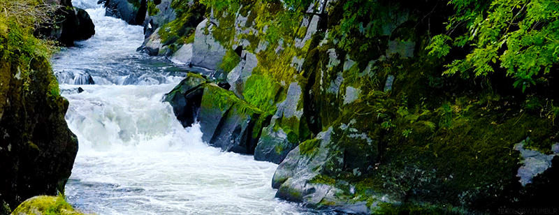
RIVERS
Our seas contain around 97% of the Earth’s water. The remaining 3% is fresh water. The majority of this freshwater is trapped in glaciers and packed ice or underground. Rivers and lakes contain only around 0.3% of the world’s water. Nonetheless, rivers play a crucial part in both the water cycle and human existence.
A river is a relatively big body of water that runs in a channel and drains excess water away from the land. The beginning of a river is referred to as its source. The source of a river can be a spring, a lake, or even a glacier. The mouth of a river is where it comes to an end. A river’s course may end in a sea, ocean, or lake.
A tributary is a river that flows into another river. A confluence is a point at which a tributary joins a bigger river. A drainage system includes the main river and all of its tributaries. A drainage basin is all of the territory drained by a river and its tributaries. A watershed or divide is the high ground that separates one drainage basin from another.
Drainage Schemes
A river and its tributaries frequently follow a distinct pattern known as a drainage pattern.
Pattern of dendritic drainage
The term dendritic is derived from the Greek word for tree (dendron). This drainage pattern is shaped like a tree, as its name suggests. The major river resembles the trunk of a tree, the tributaries like the branches, and the tiny streams resemble twigs. Dendritic drainage patterns arise in locations with homogenous rock types and gently sloping soil. In other words, when there are no strong geological forces impacting drainage patterns, this pattern is likely to emerge.
When rivers flow away from a center area of high ground, they form a radial drainage pattern. Rivers flowing down the slopes of volcanoes or domes provide excellent examples of radial drainage systems (see diagram below).
Drainage via trellis
When tributaries join a main river at right angles, trellis drainage patterns form. This pattern is common in places with alternating bands of resistant and less resistant rock at right angles to the slope’s direction. The main river flows across the rock bands, following the land’s slope. Tributaries join the main river at right angles after following regions of less resistant rock.
Rivers’ Contribution
Rivers have a significant impact on the terrain. They are responsible for three sorts of work: erosion, transportation, and deposition.
What causes a river to erode?
The removal of weathered material by factors such as wind, water, and ice is referred to as erosion. Running water is one of the most effective and powerful agents of erosion. A river erodes in a variety of ways:
The power of the water itself is referred to as hydraulic action. Water rushes against the riverbanks, forcing its way through cracks and holes. This loosens material along the river’s bed and banks, and the river transports it away.
Some minerals found in rocks and soil are soluble. As they come into contact with river water, they slowly dissolve. Salt and calcium carbonate are two examples of such minerals.
Corrosion/Abrasion: The river grinds its load against its bed and banks as it runs. This loosens the material carried downstream by the river.
Attrition refers to the process by which river materials, such as rocks and stones, collide with one another. They get smaller and smaller over time. They also smoothen and round out.
The phrase transportation relates to how a river transports stuff. The stuff carried by a river is referred to as the river’s load. A river transports its cargo in a variety of ways:
Solution: Dissolved materials in water are moved downstream.
Suspension: As the river moves, tiny particles such as silt are suspended in the stream. River water typically appears brown during periods of heavy rainfall due to the amount of debris floating in it.
Saltation occurs when particles such as tiny stones are bounced along the riverbed as they go downstream.
Traction: The river’s heaviest material, such as huge rocks, is simply rolled along the riverbed.
There are many vital aspects of a river, but we won’t go over them all. We’ll give you a quick rundown of the most significant points. This way, you’ll have some background while discussing or reading about these bodies of water.
PARTS OF A RIVER
Drainage Basin
A drainage basin is defined as a broad area where precipitation collects and then flows into a shared outlet point. The drainage basin includes all precipitation that eventually funnels into the same area as well as all groundwater beneath the surface in that area.
Rivers rely on drainage basins to provide the water they require to flow. The basins, however, are of various sizes. Some of them can cover thousands of square miles. The largest ones, such as the Amazon River drainage basin, cover an area of up to 2 million square miles!
This is a basic definition of a significant and complex concept. True drainage basin studies will frequently incorporate features of landform, soil, vegetation, and much more.
The phrases headwaters and source are synonymous, and both refer to the streams or lakes that serve as a river’s source. The Mississippi River, for example, is considered to begin in Lake Itasca, Minnesota.
However, because that lake is fed by numerous streams, one of them would legally be the waterway’s genuine headwaters or source. Finding the headwaters necessitates considerable work and some assumptions. This sometimes leads to disagreements concerning the lengths of different canals in relation to one another.
Watercourses (Affluent)
Tributaries are streams and other water sources that feed into the river as it flows. A tributary is a river that flows into another river. The overall flow of water in the stream is increased by tributaries.
Convergence
A confluence is where two rivers meet and merge into one body of water. The meeting of the White and Blue Niles in Khartoum, Sudan, is an example of a large confluence. The result is the Nile River, which flows north into Egypt and the Mediterranean Sea.
Channel
The term “channel” can refer to a variety of things, but for our purposes, a channel is a passage or confinement for a body of water. The term channel is sometimes used to refer to rivers, although it can also refer to straits and deltas.
A riverside is the land on the river’s bank. Cities are frequently built on riverbanks so that residents can benefit from the freshwater that flows through them.
Riverbanks act as a barrier between the water and the land beside the river. Riverbanks are present on both sides of the river and are higher than the water flow.
Flood plain
The floodplain of a river is the low-lying region adjacent to the river that is prone to flooding when higher-than-normal discharges occur. These normally flat expanses of land extend all the way to the valley’s edge, where the river is located.
Floodplains can be fairly large, and they have always been vital to agriculture. Although it may be paradoxical to develop a home or farm on a floodplain, the level location, high-quality soil, and transit options are too appealing to pass up. Floods in these locations, of course, can be disastrous.
- Mouth
The river mouth is the point at which the stream pours into a larger body of water. This can be a river confluence or the point at which water flows into a gulf or directly into the ocean. This is sometimes referred to as a delta, but the term has a more precise meaning that we’ll discuss shortly. - Flow (The Most Obvious Parts of a River) (The Most Obvious Parts of a River)
What is a river if there is no water? The flow is the water that runs through the river. Humans pay close attention to the flow because slight changes over time can cause the flow to shift to a different location. Human intervention, for example, is the sole thing preventing the Mississippi River from changing course.
Humans must also consider the flow discharge or the volume of water pouring out of the river. Pollution dispersion and erosion are two significant effects of river discharge.
Delta and mouth are terms that are used interchangeably. Technically, the terms might refer to the same thing. Deltas, on the other hand, are best defined as wetlands near river mouths when the terrain flattens and the water flow expands into a fan form.
At a delta, several smaller streams known as distributaries function as exits into a larger body of water. Furthermore, silt buildup permits river water to move outside of its usual path and banks. The river slows here, and the water pours into the next body of water in several streams that originate from the same channel. However, not all rivers have deltas.